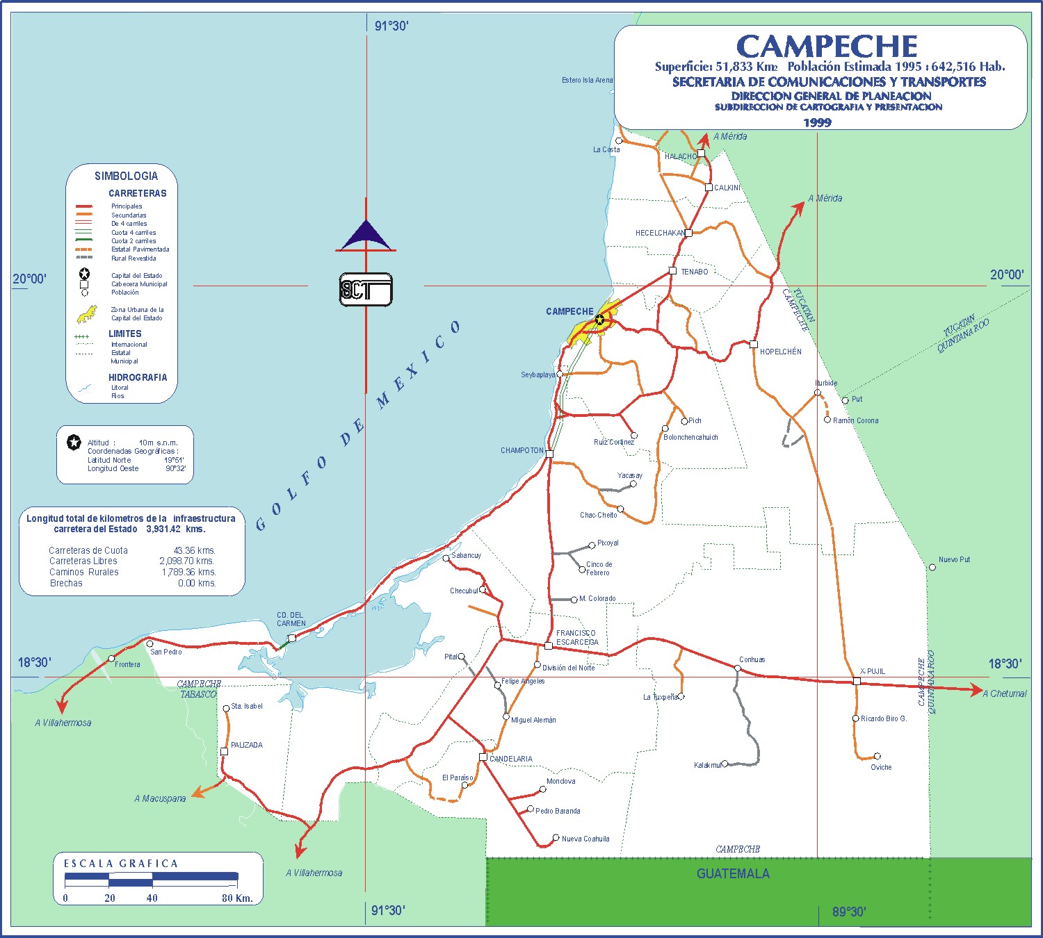
If you look at a map of Campeche state Mexico, you might think it’s just a flat, green thumb sticking out into the Gulf. It's easy to miss. Most people fly right over it on their way to the beach clubs of Cancún or the ruins of Chichén Itzá. Honestly? That's a mistake.
Campeche is weird. I mean that in the best way possible. It’s a place where the geography dictates a very specific kind of lifestyle that hasn't changed much in decades. When you pull up a map of Campeche state Mexico, you're looking at a massive territory—roughly 22,000 square miles—that is mostly jungle, limestone, and water. It borders Yucatán to the northeast, Quintana Roo to the east, and Tabasco to the southwest. Down south, it shares a rugged, often ignored border with Guatemala.
The first thing you’ll notice is the coastline. It’s long. It stretches for hundreds of miles along the Bay of Campeche. But unlike the turquoise Caribbean side of the peninsula, this water is shallow, greenish, and full of shrimp. It’s a working coast.
The Layout of a Fortress City
The capital, also called Campeche (or San Francisco de Campeche if we're being formal), is the heart of any map of Campeche state Mexico. It's a UNESCO World Heritage site for a reason. Back in the 1600s, pirates—real ones, like Laurent de Graff and Henry Morgan—kept sacking the city. The Spanish got tired of it and built a massive hexagonal wall.
Today, the "Centro Histórico" is a grid of pastel-colored houses. If you're looking at a street map, you’ll see "Calle" numbers. Even numbers run one way, odd numbers the other. It’s incredibly easy to navigate. The city is defined by its baluartes (bastions). These are the heavy stone corners of the old wall. Seven of the original eight still stand.
You’ve got the Puerta del Mar (Sea Gate) and the Puerta de Tierra (Land Gate). Standing at the Land Gate during the light show, you realize how small the original city was. The map shows a compact, defensive nut that the jungle and the sea couldn't crack. Outside the walls, the city spills out into "barrios" like Guadalupe and San Román, each with its own church and distinct vibe.
The Empty South and the Calakmul Mystery
Zoom out on that map of Campeche state Mexico. Look south. See all that green? That’s the Calakmul Biosphere Reserve. It’s one of the largest protected areas in Mexico.
Most maps just show a vast empty space with one thin line—Highway 186—cutting across the bottom toward Chetumal. This is where things get interesting. Deep in that green void sits Calakmul. It was a superpower. For centuries, it feuded with Tikal in Guatemala.
The geography here is brutal. It's "karst" terrain, meaning the limestone is like Swiss cheese. There are no major rivers in the north or center of the state. The Maya had to build aguadas (reservoirs) to survive. When you visit, you aren't just looking at ruins; you're looking at an ancient feat of water engineering.
The scale is hard to grasp. Structure II at Calakmul is one of the tallest pyramids in the Maya world. From the top, you don't see cities. You don't see roads. You just see a carpet of broccoli-like trees stretching into Guatemala. It’s silent.
The Chenes Route: Architecture Hidden in the Scrub
North of the jungle but south of the capital lies the Chenes region. If you look at a map of Campeche state Mexico, find the town of Hopelchén. "Chen" means "well" in Maya. This area is dotted with sites like Hochob and Santa Rosa Xtampak.
The style here is "Monster Mouth" architecture. The doorways are carved to look like the gaping maws of the earth monster. It’s spooky and brilliant. Unlike the Puuc hills further north in Yucatán, the Chenes sites are often flat and tucked away in farming communities.
You’ll see Mennonite communities here too. They moved in decades ago. It’s a surreal sight on the Campeche map: tropical jungle, Maya ruins, and horse-drawn buggies driven by people speaking Low German. This isn't the Mexico most people imagine.
The Coastline and the "Forgotten" Ports
Follow the coast southwest from the capital. You’ll hit Champotón. This is where the river meets the sea. Historically, it was called the "Coast of the Evil Tick" because the local Maya fought off the Spanish so fiercely during the first expeditions.
Further down is Ciudad del Carmen. On a map of Campeche state Mexico, this looks like a long sliver of an island (Isla del Carmen) plugging the mouth of the Laguna de Términos. This is the oil hub. It’s wealthy, busy, and feels entirely different from the colonial charm of the capital.
The Laguna de Términos is a massive tidal lagoon. It’s a sanctuary for dolphins and manatees. The map shows it as a huge bite out of the coastline. It’s actually one of the most important ecosystem hotspots in the Gulf of Mexico.
Why the Topography Matters
Campeche is flat. Mostly. There are some low hills in the north, part of the Puuc range, but it’s generally a low-lying limestone shelf.
This flatness means that when it rains, it floods. There are no mountains to funnel the water into neat rivers. Instead, the water sinks into the ground or sits in "bajos" (lowlands). This has kept large parts of the state undeveloped.
Agriculture is tough. The soil is thin. In the north, it’s all about citrus and honey. In the south, it’s timber and cattle. The map of Campeche state Mexico reflects this: a few densely packed towns and a whole lot of nothing in between.
Navigation Realities
Don't trust travel times on a map implicitly. While the main toll roads (cuotas) are decent, the "libre" roads can be an adventure. Potholes in the jungle regions aren't just holes; they're ecosystems.
- Highway 180: This is your lifeline. It hugs the coast and connects Campeche to Mérida and Villahermosa. It’s beautiful but slow through the villages.
- The Escárcega Junction: Look for this on the map. It’s a dusty crossroads town. It’s the gateway to the south. You will likely pass through it, and you will likely get confused by the signage. Just keep heading toward Chetumal if you want the ruins.
- Gas Stations: They are sparse once you leave the main corridor. If you’re heading into the Calakmul area, fill up in Escárcega or Xpujil. No exceptions.
The Maya Legacy on Modern Maps
Many of the names you see on a map of Campeche state Mexico are Mayan. Hecelchakán, Calkiní, Dzibalchén. These aren't just historical footnotes. The language is still spoken in the markets.
The state is divided into 13 municipalities. The newest ones, like Seybaplaya and Dzitbalché, were only recently carved out. This shows that while the state feels "old," it’s still politically evolving.
The "Camino Real" region in the north is famous for its artisans. If you find Bécal on the map, that’s where they weave the Panama hats (Jipijapa) in limestone caves. The caves provide the humidity needed to keep the palm fibers pliable.
Practical Insights for Travelers
If you are actually using a map of Campeche state Mexico to plan a trip, here is the ground truth.
First, the capital is your base. Spend three days there. Walk the Malecon (the sea wall) at sunset. The map shows it as a long curve; in reality, it’s where the whole city comes to exercise and eat marquesitas.
Second, understand the distances. Driving from Campeche City to Calakmul takes about four to five hours. It’s a long day. Most people stay overnight in Xpujil.
Third, watch the seasons. From June to October, the "green" parts of the map get very, very wet. Mosquitoes in the southern biosphere aren't just pests; they are a formidable infantry.
Campeche isn't a place you "do" in a weekend. It's a place you absorb. The map is just a skeleton. The meat is in the fried shrimp in Champotón, the silence of a jungle pyramid, and the way the light hits the yellow walls of the cathedral at 5:00 PM.
Actionable Steps for Your Journey
- Download Offline Maps: Cell service is non-existent once you get 20 miles inland from the coast. Use Google Maps' offline feature for the entire state.
- Locate the 'Paradores': Identify the official rest stops along Highway 180. They are the safest spots for food and bathroom breaks during long hauls.
- Identify Xpujil as a Hub: If you're doing the ruins, mark Xpujil on your map. It’s the only place with reliable lodging, mechanics, and supplies near the biosphere.
- Check the 'Cuota' vs 'Libre' Routes: Always choose the toll road (Cuota) between Campeche and Mérida if you value your car’s suspension and your own time.
- Verify Coastal Access: Many areas on the map look like beaches but are actually mangrove swamps. If you want a swim, stick to designated areas like Playa Bonita near the capital or the beaches of Isla Aguada.